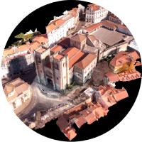
In support of Topography, Cartography & Structural Inspection
“Great accuracy and speed at a lower cost when compared to traditional methods. Custom-made, high resolution and quality recording, processing and delivery within a short period of time.”
“Drones with GNSS RTK system”
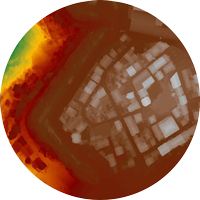
Creation of Digital Terrain Models & Digital Surface Models
Pin It on Pinterest
We use cookies to ensure that we give you the best experience on our website. If you continue to use this site we will assume that you are happy with it.